Computer vision gives a drone something that a remote pilot normally provides: a way to turn pixels into an understanding of the environment. A camera alone records light. A vision system tries to answer harder questions — what is in the image, where it is, how it is moving and how the aircraft itself is moving through the scene.
That distinction explains why computer vision is becoming central to unmanned systems. It can reduce dependence on continuous human observation, help a drone navigate when satellite positioning is degraded, maintain tracks through communications interruptions and allow several aircraft to divide sensing tasks without every decision passing through an operator.
But 'AI vision' is not one capability. Detection, classification, tracking, localization and navigation are separate problems. A system can perform one well and fail at another.
The camera is only the sensor
A drone camera produces frames. Computer vision turns those frames into measurements.
At the simplest level, software can identify visual features — edges, corners, texture and motion. More sophisticated models can detect classes of objects, estimate where an object sits in the image, maintain an identity as it moves across successive frames and combine visual information with inertial or other sensors.
The useful output is therefore not necessarily a picture. It may be a bounding box, a track, a relative bearing, an estimate of motion, a confidence score or a map feature that another part of the flight software can use.
| Function | Question it answers | Typical output |
|---|---|---|
| Detection | Is an object of interest visible? | Object location in the image plus a confidence score. |
| Classification | What category does it appear to belong to? | A label or probability distribution. |
| Tracking | Is this the same object seen in the previous frame? | A persistent track over time. |
| Visual odometry | How has the camera moved? | Relative motion estimate. |
| Scene understanding | What parts of the image are terrain, obstacle, structure or free space? | Masks, depth or semantic regions. |
| Visual navigation | How does what the camera sees relate to the aircraft's route or map? | A position or navigation correction. |
Detection is not the same as recognition
A vision model may be able to detect that an object is present without knowing exactly what it is. It may also assign a class label without having enough context to support a mission decision.
This is important because machine perception is probabilistic. The system is not 'seeing' in the human sense. It is matching patterns in current sensor data against patterns learned during training.
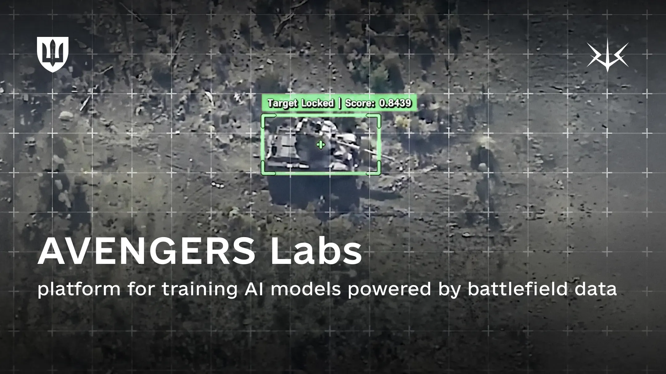
Ukraine's Avengers Labs makes the data requirement unusually visible. The Ministry of Defence says the platform is built around more than five million annotated battlefield frames drawn largely from the DELTA combat system. The dataset covers ground and aerial objects and is continuously updated as battlefield conditions change.
The reason annotation matters is that a learning system needs examples tied to labels or other structured information. Raw video is abundant; reliable labels are expensive.
Training data defines the world the model expects
A model trained mostly on clean daylight imagery may struggle in haze, low light, snow, dust or thermal imagery. A model trained on one sensor can behave differently when the optics, resolution or compression change.
Military environments accelerate this problem because the visual world changes. Vehicles are modified. Camouflage patterns evolve. Decoys appear. Sensors are replaced. Terrain is damaged. Seasonal conditions change.
This is why battlefield datasets are strategically valuable. They contain the noise, sensor artifacts, partial visibility and environmental variation that are difficult to reproduce on a controlled test range.
On 25 September 2026, Ukraine announced that the United Kingdom would become the first international partner in Avengers Labs. The ministry said more than 30 Ukrainian defence companies were already training models in the secure environment and that the underlying dataset would remain inside the platform rather than being downloaded by participants.
Tracking adds time to a single frame
A detector answers what appears to be in one image. A tracker answers what happened next.
Tracking systems try to associate observations across successive frames. If a moving object temporarily passes behind an obstruction, changes size as range changes or rotates into a different view, the tracker must decide whether the new observation belongs to the same track.
This temporal continuity is important because many autonomous functions depend on motion rather than a single snapshot. Navigation needs to understand how the scene changes as the aircraft moves. Collision avoidance needs relative motion. A human supervisor benefits from stable tracks rather than a new set of detections every frame.
Tracking is therefore often the bridge between perception and action.
Visual navigation uses the world as a reference
Computer vision can also help a drone estimate its own movement.
Visual odometry measures how features shift across a sequence of images and uses that change to estimate camera motion. Combined with an inertial measurement unit, the system can maintain a local navigation estimate even when GNSS becomes unreliable.
NATO's SAPIENCE programme demonstrates this broader role for perception. In its 2026 competition, university teams flew multiple UAS in a simulated disaster environment without satellite positioning. The aircraft had to navigate, map, sense obstacles, identify survivors and cooperate without direct piloting.
The value of vision here is not that it replaces every navigation sensor. It provides another independent source of information that can constrain drift and support local decisions.
Depth is one of the hardest things to infer from a flat image
A standard camera records a two-dimensional projection of a three-dimensional world. The flight system still needs to understand distance.
There are several conceptual ways to obtain that information. Multiple cameras can infer depth from geometry. Motion can create parallax. Dedicated sensors can provide range. Learned models can estimate depth from visual patterns.
Each method comes with trade-offs in compute, calibration, weight, lighting sensitivity and reliability. A system designed for a small quadcopter cannot assume the same sensor package as a large unmanned aircraft.
This is why computer vision on drones is constrained by size, weight and power as much as by algorithms.
Edge computing changes what the drone can do when the link disappears
If every frame must be transmitted to a ground station before it is interpreted, the aircraft remains dependent on bandwidth and connectivity.
Moving perception onto the aircraft changes that architecture. The drone can process imagery locally and transmit higher-level information instead of raw video, or continue some functions during a communications interruption.
DARPA's REMA programme is built around this idea at a broader mission level: add an autonomy subsystem to commercial and military drones so more mission logic can remain onboard when communications are contested.
The trade-off is compute. More local perception means more processor demand, more electrical power and more heat.
Computer vision is becoming a bandwidth-management tool
DOCUMENTSAPIENCE provides a concrete example of perception, navigation and cooperation in a GNSS-denied multi-UAS scenario.OPEN ↗Autonomy is often discussed as a replacement for human control, but vision can be valuable even when humans remain deeply involved.
A model can filter large amounts of imagery and surface only the frames or tracks that appear relevant. This changes the operator's job from watching every pixel to reviewing machine-generated candidates and exceptions.
Ukraine's Ministry of Defence says the Avengers AI system integrated into DELTA processes more than 100,000 UAV video streams per month and detects a large share of enemy military objects automatically. Those figures are official Ukrainian claims rather than an independent benchmark, but they illustrate the scale problem: no human team can manually inspect unlimited video in real time.
At fleet scale, perception becomes partly an information-compression problem.
Why vision models fail
The same characteristics that make computer vision useful also create brittleness.
A model can be confident and wrong. It can fail on an unfamiliar viewing angle. Background clutter can resemble the object class it learned. Motion blur, compression, smoke or low contrast can erase the features the model depends on.
A visual system can also fail because the sensor fails rather than because the model fails: dirty optics, vibration, exposure changes and damaged cameras all change the input distribution.
For military systems, this makes uncertainty handling essential. A model should not only produce an answer; the wider system needs to know how much confidence to place in that answer and what to do when independent sensors disagree.
Sensor fusion is stronger than vision alone
The most robust autonomous drones do not ask cameras to solve every problem.
Vision can be combined with inertial sensing, radar, lidar, GNSS when available, radio measurements or other sensors. Each source has different error characteristics.
The navigation system can then use vision when the scene is informative and rely more heavily on other measurements when it is not. The same principle applies to detection: a radar or RF system may establish that something is present, while EO/IR provides visual classification.
Computer vision therefore becomes part of a larger estimation architecture rather than a self-contained intelligence module.
Multi-drone autonomy turns perception into a shared resource
When several drones operate together, each aircraft does not necessarily need to understand the entire environment independently.
SAPIENCE explored cooperative behaviour in which multiple aircraft could divide tasks and continue operating when individual links or vehicles were lost. That points toward a future in which perception is distributed: one vehicle maps, another confirms, another carries a payload, and the group combines partial information.
This is more demanding than simply flying many drones at once. The software has to manage shared tracks, conflicting observations and incomplete communications.
The result is a shift from one camera feeding one operator toward networks of sensors feeding a common mission picture.
Computer vision moves the bottleneck from pilots to data and verification
As perception improves, the limiting resource changes.
A remote-control fleet is constrained by pilots and radio links. A vision-enabled autonomous fleet is increasingly constrained by training data, processors, testing, model updates and the ability to verify that software still behaves correctly after those updates.
That industrial change is already visible in Ukraine. Avengers Labs is not a drone factory; it is data infrastructure for many drone companies. NATO research programmes similarly separate autonomy and perception from any one airframe.
The implication is that competitive advantage can sit in a dataset or software pipeline as much as in the vehicle.
The right way to understand computer vision in drones
Computer vision does not make a drone 'see' the way a person sees.
It converts imagery into estimates that other software can use: detections, tracks, motion, maps, depth and confidence.
Those estimates can reduce operator workload, improve navigation resilience and support more autonomous mission behaviour. But every capability depends on training data, sensor quality, processing power and testing across the conditions the aircraft will actually encounter.
The camera is becoming more than a video feed. It is becoming a measurement instrument — and the software interpreting it is becoming part of the flight system itself.