A drone does not need GPS to stay in the air. It needs a way to estimate where it is, how it is moving and how that estimate relates to the mission it has been given.
GNSS normally makes that problem dramatically easier. Satellite navigation provides a global reference that is compact, cheap and accurate enough for an enormous range of unmanned systems. But in contested environments, the signal can be jammed, spoofed, obstructed or simply unavailable.
The response is not one replacement technology called 'GPS-denied navigation.' It is a stack of techniques: inertial sensors, cameras, terrain and map references, other radio or environmental signals, and algorithms that combine imperfect measurements into a usable position estimate.
The key concept is resilience. A drone that loses one navigation source should not immediately lose its understanding of where it is.
Position, navigation and timing are three related problems
GNSS is often discussed as though it provides only a dot on a map. Military systems depend on it for a broader set of functions grouped under positioning, navigation and timing — PNT.
Position answers where the system is. Navigation connects that position to motion and a route. Timing provides a precise common reference that many sensors, radios and networks also depend on.
DARPA's Adaptable Navigation Systems programme begins from this broader problem. It describes GPS as extremely useful but vulnerable to jamming and unavailable in environments such as buildings, urban canyons, dense foliage, underwater and underground.
For drones, the challenge is therefore not simply replacing latitude and longitude. It is maintaining enough state information for the aircraft to control itself and accomplish its task when an external global reference becomes unreliable.
| Navigation variable | Why it matters | Possible non-GNSS source |
|---|---|---|
| Attitude | Which way the aircraft is oriented | Gyroscopes, accelerometers and onboard flight-control estimation. |
| Velocity | How fast and in what direction it is moving | Inertial estimation, visual motion, air-data or other onboard sensing. |
| Relative movement | How the aircraft moved from a previous point | Inertial and visual odometry. |
| Absolute / map position | Where the aircraft is relative to the mission area | Terrain or imagery matching, external references, alternate PNT sources or occasional trusted fixes. |
| Time | Shared reference for some navigation and communications functions | Onboard clocks or alternate timing sources, depending on system architecture. |
Inertial navigation is the baseline fallback
The most fundamental alternative to satellite navigation is inertial sensing.
An inertial measurement unit uses accelerometers and gyroscopes to estimate changes in motion and orientation. Unlike GNSS, it does not need an external radio signal. The aircraft can therefore continue estimating its movement when satellite reception disappears.
That independence is why inertial navigation appears in almost every serious discussion of assured PNT. DARPA's ANS programme explicitly combines improved inertial measurement with alternate external fixes and software architectures capable of incorporating different sensors.
The weakness is drift.
Tiny measurement errors accumulate when the system repeatedly integrates acceleration and rotation over time. An inertial solution can therefore be very good at telling the aircraft how it moved over a short interval while becoming progressively less certain about its absolute location.
Higher-quality inertial sensors reduce that drift, but they usually increase cost, size, weight or power demand. That trade-off is especially important for small drones, where the navigation package competes for limited mass and electrical power.
Visual navigation turns the environment into a reference
Cameras provide another way to estimate motion without asking a satellite where the aircraft is.
DOCUMENTDARPA’s ANS programme frames resilient navigation around better inertial sensing, alternate external fixes and all-source sensor integration.OPEN ↗Visual odometry tracks how features in successive images move. If the system can estimate how the camera moved relative to those features, it can estimate the aircraft's own motion.
Visual-inertial odometry combines that camera-derived movement with inertial measurements. The two sources are complementary: inertial sensors update quickly but drift; cameras can constrain some of that drift by observing the environment.
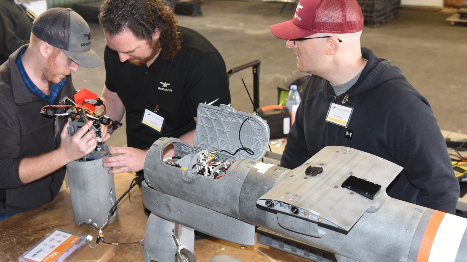
The U.S. Navy's Joint Interagency Field Experimentation programme has repeatedly tested this class of technology. Naval Postgraduate School reporting describes Rhoman Aerospace integrating a GPS-denied autonomous navigation and manoeuvring system into Firestorm Labs' Tempest drone, using passive sensing and onboard processing as part of an alternative-PNT approach.
CSIS has documented a related operational adaptation in Ukraine: Skydio said it used visual-inertial odometry and software changes to improve performance in environments affected by GNSS jamming and spoofing.
The attraction is obvious. Cameras are already common on drones, and passive vision does not need to transmit a navigation signal. But visual navigation depends on what the camera can see.
Vision has its own failure modes
A camera does not create an absolute navigation solution simply because GNSS is absent.
Visual systems need observable features. Low contrast, darkness, weather, repetitive terrain, motion blur or a feature-poor environment can reduce the quality of the estimate.
Altitude changes the problem too. A small aircraft close to buildings or terrain sees rich visual structure but also faces rapid image motion and occlusion. A higher-flying aircraft sees a broader area but may have fewer distinctive features at the resolution available to its sensor.
Computer vision also consumes processing power. More robust perception can require better cameras, more compute and more electrical energy — all expensive resources on a small airframe.
For this reason, GPS-denied navigation is usually stronger when vision is treated as one measurement source rather than a magical substitute for GNSS.
Maps and terrain can provide an absolute reference
Relative navigation answers how the aircraft moved. Eventually, many missions also need to know where that movement places the aircraft in the world.
One solution is to compare onboard observations with a reference map or terrain model. If the system can associate what its sensors see with known features, it can correct accumulated drift and recover an absolute location estimate.

The principle is older than modern drones. Terrain-aided navigation has long been studied for aircraft operating when satellite navigation is unreliable.
What has changed is the amount of perception and computation that can fit on smaller unmanned systems. Modern cameras, processors and machine-learning models can extract features that were previously impractical to process onboard a small aircraft.
The cost is dependence on data quality. A reference map can be outdated, incomplete or inconsistent with what the sensor sees. Seasonal changes, damaged infrastructure or different viewing angles can complicate matching.
Navigation can also use sources that were never designed as GPS replacements
DARPA calls one part of its approach All Source Positioning and Navigation for a reason.
The objective is not to choose one alternative to GPS but to let a navigation architecture incorporate whatever useful measurements are available for a particular mission.
Those sources can include inertial sensors, environmental references and other external signals. The precise mix varies by platform and operating environment.
This is a systems-engineering shift. Instead of building an aircraft around one trusted navigation source, the designer builds an estimator capable of accepting multiple sources with different error characteristics and availability.
The result is not perfect navigation. It is graceful degradation: losing one source should reduce confidence rather than instantly collapse the navigation solution.
Sensor fusion is the actual navigation system
A GPS-denied drone is therefore best understood as a sensor-fusion problem.
The aircraft has several imperfect measurements. Inertial sensors are fast but drift. Cameras can constrain motion but depend on the scene. Map matching can provide absolute references but may fail when the environment differs from the reference. Other sources may be intermittent or local.
The navigation software has to decide how much to trust each source at every moment.
That requires more than averaging positions together. The estimator needs a model of uncertainty: how reliable is this sensor now, how quickly does its error grow, and does another observation agree with it?
A resilient system can reject or reduce the weight of a source that becomes implausible rather than allowing it to dominate the whole navigation solution.
This principle is also relevant to spoofing. The danger of a false navigation signal is not simply that it is wrong; it is that the system may believe it more strongly than its other sensors. Cross-checking independent measurements can make that deception easier to detect.
| Source | Strength | Typical weakness |
|---|---|---|
| GNSS | Global absolute position with small, inexpensive receivers | Can be jammed, spoofed, obstructed or unavailable. |
| Inertial sensors | Self-contained and available continuously | Error accumulates over time. |
| Visual odometry | Passive relative-motion estimate using onboard cameras | Depends on lighting, scene texture, visibility and compute. |
| Terrain / imagery reference | Can correct drift against known geography | Depends on reference data and successful matching. |
| Other alternate PNT sources | Can add independent fixes or timing | Availability and coverage vary by environment and architecture. |
GNSS-denied does not mean communications-denied
Navigation and communications are separate dependencies, even though electronic warfare can affect both.
A remotely piloted drone may know exactly where it is while losing its link to the operator. Another drone may retain communications while its satellite navigation becomes unreliable.
This matters because autonomy can compensate for one problem but not automatically the other.
A system capable of local navigation can continue flying without GNSS, but if the mission requires continuous operator steering it still depends on communications. Conversely, a drone with a robust radio link may still struggle to follow a route if its navigation architecture has no alternative position source.
The most resilient unmanned systems reduce both dependencies: they can navigate locally and tolerate periods of limited communications.
Autonomy and GPS-denied navigation are converging
As more navigation intelligence moves onboard, the boundary between alternate PNT and autonomy becomes less distinct.
DOCUMENTNATO-backed university teams demonstrated cooperative drones navigating and mapping in a GNSS-denied environment.OPEN ↗A drone using vision to estimate motion already needs onboard perception and computation. Once that capability exists, the same processing stack can potentially support obstacle avoidance, local path planning or cooperative behaviour.
NATO's 2026 SAPIENCE demonstration makes this convergence visible. University teams demonstrated multiple drones navigating and mapping in GNSS-denied environments while cooperating on search-and-rescue tasks without direct piloting. NATO explicitly described the work as combining autonomous systems, AI, perception and guidance.
The programme was still at a relatively low technology-readiness level, which is an important limitation. Research demonstrations show what is technically possible; they do not automatically prove the robustness required for military fielding.
But the direction is clear: navigation is becoming a local intelligence problem rather than a passive dependence on an external satellite signal.
The navigation stack has to fit the aircraft
A large unmanned aircraft and a small FPV cannot solve GPS denial in the same way.
Larger platforms can carry higher-grade inertial sensors, more cameras, radar or lidar, more computing and larger power systems. Small aircraft face much tighter constraints.
This creates a design hierarchy. Some systems need only enough resilience to bridge short GNSS outages. Others need to complete long missions with little or no satellite access. The appropriate architecture depends on duration, accuracy requirements, payload, environment and cost.
The temptation to describe any alternative navigation package as 'GPS-independent' should therefore be treated cautiously. Independence is not binary. A system may still use GNSS when available and switch to other sources only when confidence drops.
That hybrid model is often more practical than deliberately ignoring a useful satellite signal under normal conditions.
Drift defines how long a system can stay lost
One of the most important concepts in denied navigation is error growth.
If an aircraft starts with a correct position and then loses GNSS, its internal estimate does not instantly become wrong. Uncertainty grows over time.
The rate of that growth depends on the quality of its sensors and whether it can obtain other references. A good visual or terrain match can reduce accumulated error. A featureless environment may allow the error to grow.
This means the useful question is not simply 'Can it fly without GPS?'
A better question is: for how long, over what environment and with what level of positional confidence can it continue before it needs another trusted reference?
Those performance figures are highly system-specific, which is why this explainer avoids turning laboratory range or accuracy numbers into universal claims.
Assured PNT is becoming a layered architecture
The U.S. Army's assured-PNT modernization follows the same logic at a larger scale.
Army programme material describes a modernization process built around layered PNT capabilities, modular architectures and alternative navigation rather than reliance on one replacement source. Its 2026 budget material includes an Alternative Navigation effort intended to provide incremental capability and inform future assured-PNT systems.
The significance for unmanned systems is conceptual. Resilience comes from diversity and architecture rather than from assuming one technology will become the next GPS.
DARPA reached the same conclusion years earlier with ANS: improve inertial sensing, add alternate external fixes and create algorithms that can rapidly incorporate new sensors.
Those three ideas still describe the core of the problem.
Ukraine has turned navigation resilience into a practical procurement issue
The war in Ukraine has moved GPS-denied navigation from a specialized requirement into a routine design consideration for unmanned systems.
Electronic warfare is pervasive enough that manufacturers cannot assume clean satellite navigation or uninterrupted radio links.
Ukraine's Ministry of Defence now allows units to obtain navigation systems and other drone components through the Brave1 Market using e-Points, explicitly describing the policy as a way to adapt systems rapidly to mission requirements.
Its Avengers Labs programme also supports AI models for unmanned systems using battlefield data, including scenarios where a drone can perform more of the mission locally rather than depend on continuous remote control.
The procurement implication is that navigation resilience is no longer only a premium feature of high-end aircraft. It is becoming a competitive characteristic across much cheaper systems.
What GPS-denied navigation still cannot solve
Alternate navigation does not make an unmanned system invulnerable.
Inertial sensors drift. Cameras can be blinded by poor conditions. Map matching can fail. Compute can overheat or consume scarce power. Sensors can disagree. The software that fuses them can make a bad decision.
The environment can also remove several sources at once. A dark, feature-poor or visually degraded area may weaken camera-based navigation while communications are simultaneously disrupted.
Resilience is therefore probabilistic. Each independent source gives the system another way to maintain state, but every architecture has conditions in which confidence deteriorates.
This is why realistic testing matters. A navigation stack that works on a mapped test range with clear weather may behave differently over damaged urban terrain, snow, forest, water or at night.
The right way to understand GNSS-denied navigation
A drone flying without reliable GPS is not navigating by one secret replacement technology.
It is estimating.
It combines what its inertial sensors say about motion with what cameras or other sensors observe, compares that information with maps or alternate references when available, and continuously updates its best estimate of where it is.
GNSS remains extremely valuable because it provides a simple global reference. The goal of assured navigation is not necessarily to eliminate GNSS, but to prevent its loss from becoming a single point of failure.
That is the deeper change in unmanned warfare. Navigation is moving from a receiver to an architecture.